Saturday, December 15, 2012

Matador's Southbound cruise from Maine

Never having planned to go to Maine, once there we thought we'd make the most of it. We enjoyed the Bangor music festival and the Camden Windjammer festival, but we couldn't leave without visting the wonderful Acadia National Park at Mount Desert Island. It is a beautiful area, costs a huge $5 per week to enter the park, and this includes free buses linking the hiking and biking trails. A bargain! It is often difficult for us to access hiking trails, and requires a safe anchorage to leave the boat while we trek up big hills all day, and MDI has just this at Somes harbour

Somes Harbour anchorage 4th September 2012
44 21N 068 19W
A foggy morning in Somes Harbour
This is a lovely little bay. There is a private dinghy dock, but the locals tolerate visitors using their dock, for a contribution to the honesty box. Its a short walk up the lane to the road, and the bus is used to picking up people in the layby, even though it is not marked as a bus stop. All the buses have bike racks front and back, so you can bus your bike to the trails, and avoid cycling on the surprisingly manic roads. Every day we took the morning bus to Bar harbour, which is the hub for the buses and trails, has supermarkets, bars, shops and the tourist info centre for maps.

We bought a hiking map for $5 and wore it out after a week. Gorgeous walks, lovely views, and safe cycling. It was worth all the miles just for this one place. The cycling is fairly tame on forest roads and carriage roads, shared by the horse and carriages for the more sedate tourists who visit the park.
Stu's back, my usual view from my bike
Labour Day holiday weekend (3rd September) is the end of summer holidays for Americans, and the park was quieter as a result. The weather turned quite quickly autumnal as well, though we had warm and sunny days for our hill walking.
One tree has decided it is autumn!
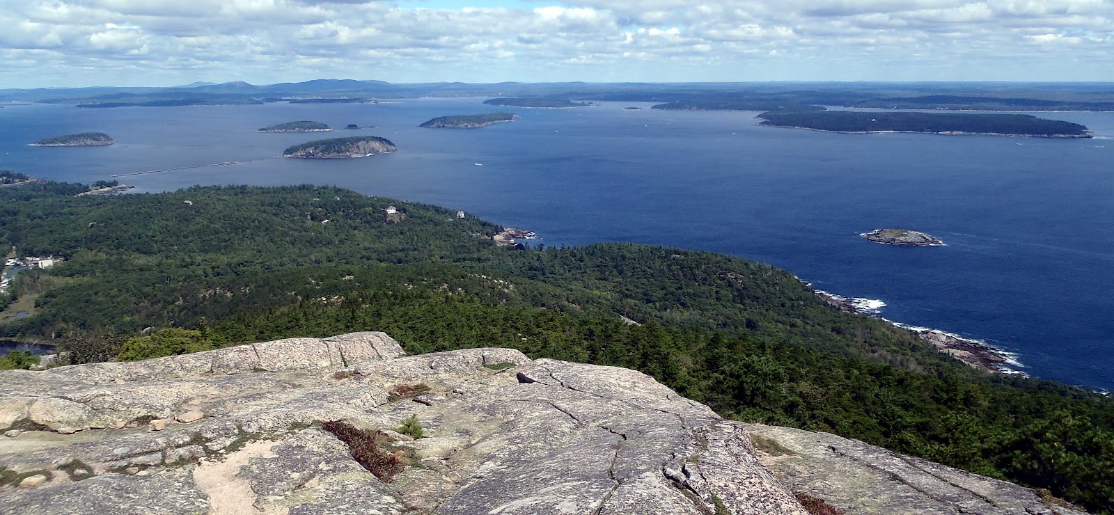

We were sad to leave MDI, but knew we had a lot of miles to go south. We heard bad news from Yindee Plus, that Sue had taken a nasty fall and broken some ribs, so we decided to head back to them in the amazing Seal Harbour gunk hole, and see how the patient was doing.

Seal Bay, Vinalhaven 13 September
44 05N 068 49W

A really stunningly beautiful, natural harbour, protected from all winds. There are a few holiday homes around the bay, most of them closed up after the summer. We took advantage of someones waterfront access to park the dinghy, taking the bikes ashore to cycle a few miles to the little town that serves the population of 1200 people. We did this several times as there was no phone signal in the bay, and no internet. Sue was coping really well on board and managing short forays off the boat, so we just hung around enjoying the scenery and gave moral support. It was very hard to tear ourselves away from this pristine anchorage.
Vinalhaven has a very large tidal range, and we were unaware how much we had got out of the habit of accounting for tidal height when going ashore. One day we parked the dinghy, anchored well off in deep water, with a line ashore. We cycled into town for supplies and wifi.
When we came back we were amazed how much we had misjudged it!

  The dink is perched on a rock high and dry!
Thought we'd anchored the dink far enough out, but the anchor was high and dry too.


We took the engine off, and carried the dink to the water, loaded it up with bikes and shopping. It was not floating very well, so we thought we would wait for the tide to come in a bit.
So we sat and watched the tide roll OUT, further and further. It was a lowest spring tide of the year!! A tiny trickle remained in the deep mud. There was no way of getting the dink to the water now, we'd just have to sit and admire the sunset, eat the shopping, drink the beer and wait for the boat to refloat. It was dark and chilly when we got home!
Feeling pretty stupid by this point!

Nice sunset though
Time to move on, even Yindee Plus were on the move, with Becca joining as crew to help out.
Maine is absolutely chocker with lobster pots, so we don't like to motor or sail at night there, though many do and get away with it. We still have vivid memories of being caught on that fishing net off the Portuguese coast. It is the slow way south, coast hopping by day, but we preferred to be slow and safe, retracing our route via Boothbay Harbour and Gloucester.

Provincetown, Cape Cod 25 September
42 02N 070 11W

The gay seaside resort of Cape Cod. Shame we missed the bear festival earlier in the year. Bears: ' a subculture of gay men who embrace natural body hair' ! Bear week is the time to parade it for all to see apparently! Check out the photo gallery if you dare:
Provincetown Bears

It was too chilly and windy now for parading body hair. It blew old boots, and we sat it out for a couple of days here. A flock of little birds roosted on the boat, despite us chasing them off frequently. I didn't mind them finding shelter from the wind, but they rewarded us with bucket loads of crap over the decks, bimini, water catcher, yuk.....

As soon as possible we moved on, timing our arrival at the Cape Cod canal to get on the magic carpet tide carrying us through at 10 knots. It was still windy the other side, from behind, so we made up a few miles, anchoring at the charmingly named Fogland on the rural side of Rhode Island. It was a pretty little spot, surrounded by mansions and farms, but we moved into Newport town to meet Kurt and Katie on Interlude

Newport, Rhode Island
41 28N 071 19W anchored among the moorings

In the heyday of the USA, when entrepreneurs were making buckets of cash building roads, railways, well, building the new country really, there was no income tax. The richest people in America built their summer 'cottages' at Rhode Island. These palaces or mansions are vast, and inspired by the riches of European cities. For the princlely sum of $18 each per house, they are all open to the public, filled with the beautiful objects donated by the families in lieu of inheritence tax. We made do with gazing at them from the sea in our own holiday cottage. It was fun to catch up with Interlude, they were waiting for the right wind to make an offshore passage all the way to the BVI's. The quick way to get south – but we still had not visited New York and Washington, so we carried on plodding south and west ino Long Island Sound..

Mystic Seaport Museum 1 October
41 21N 071 57.9W

The musuem of America and the Sea. More than a museum, it is actually a small 19thC village. There are all the usual shops you would find - a watch maker, cooperage, rope maker, hardware store. They have actors in period costume, enacting the activities of the age. There are whaling and cod fishing sailing boats to visit, ones that actually did fish the Grand Banks. It is a working village as well, and historic ships come here to be refitted or preserved with traditional materials and skills.
The best bit of all is for foreign-flagged boats, they offer a free berth for a night, and free entrance to the museum/park. Bargain, and a very eductional place to visit too, with free hot showers and a washing machine we were in heaven.


Port Washingon - access to New York City
Mooring 40 49N 073 43W

No reason to visit Port Washington other than it being at the end of a rapid transit train route to New York city and they generously provide free mooring buoys for 1-2 nights. Many cruisers stayed here for up to a week and did not get charged for their stay. It was pretty empty when we were here, with a real end of season feel. It is a 20 minute walk to the train station and costs $15 return each on the train, but you pop up in the centre of Manhattan at Madison Square Gardens.

79th Street Basin marina and mooring buoys
40 41N 074 02W 9 Oct 2012, $30 per night for moorings

We did several train trips into the city to explore, before sailing around the island of Manhattan, to 79th Street Basin, very close to Central Park. We took at buoy there for a couple of nights, so we could spend time out in the evenings, without a long trip home.

We loved the city, and really enjoyed our cultural experiences there. Many museums have a slot once a week where you 'pay what you wish' or free entrance, and we took full advantage of these to see as much as possible on a budget, even if the queuing was a bit tedious.

  Times Square – enjoy the bright city lights for free!!

Perhaps the most photographed man in New York?

Empire State Building
An expensive view of the city at $25 pp Stu went on his own, and Steph went to see the Picasso exhibit at the Guggenheim
Twin icons of America

Frick Collection (pay what you like)
A superb collection of art in a private collection. For an industrial age man, he had very good taste and filled his Central Park mansion with some exquisite works, amongst them the Holbeins – Thomas More and Thomas Cromwell staring out from the 16th C. You could almost reach in and stroke his velvet sleeves – so amazing.

Opera – Othello
Sue and Mark (Macushla) stood in line for cheap opera tickets and kindly got some for us, as we were motoring up the Hudson River at the time. Rich patrons of the arts subsidise seats at the opera on a daily basis. We were in $200 seats for $20 – at the Metropolitan Opera no less. Magic.

Cinema – Wuthering Heights
Andrea Arnolds reinterpretation of this classic, visually stunning – it is a joy to see a decent film again.

World Trade Centre memorial
This has only recently opened. There was a competition for the design, and 'Reflecting Absence' was chosen from thousands. It really works – you can't believe the towers once stood here, among all the other skyscrapers which now reflect the skyline, it does seem quite a small footprint. The water cascades down into dark, seeming bottomless cubes, and the names of every victim are embossed around the fountains. The museum has not yet opened, but you can peer down into it to see how many stories below ground level the towers extended. Hard to believe they fell down just like that.


The Highline – a green urban renewal project – a walkway has been made from a disused overhead railway line.

Sailing under Manhattans bridges on a misty October day
A fireboat escorts a battleship down the Hudson river.
After a week in New York we were thoroughly exhausted, and we sailed down to Sandy Hook to fuel up (Long Island sound is very expensive for fuel, so we were running on fumes) and prepare for an offshore passage to the Delaware entrance. When I say expensive, that is of course relative to prices further south, not the UK. Diesel at Sandy Hook was $4/gallon or just under 65p/litre.
At 0430 we arrived at the Harbour of Refuge at the entrance to the Delaware River, we had to wait for the tide to continue up the Delaware. I can't describe how cold it was at that time of the morning, blowing 25 knots from the north. The boat felt warm when we came inside, but was only 7C ! We lit the diesel heater and crawled under the duvet to recover. These October offshore overnighters are no fun at all. We wouldn't recommend coming up this way without some form of boat heating.
We spent a couple of days just riding the tide up to the Chesapeake and Delaware Canal – it saves a longer offshore route, and down the Chesapeake to Annapolis. Lots of cruisers had made it to the Annapolis boat show a week before, and were still hanging around exploring the area. It probably saved us a load of money missing the boat show.
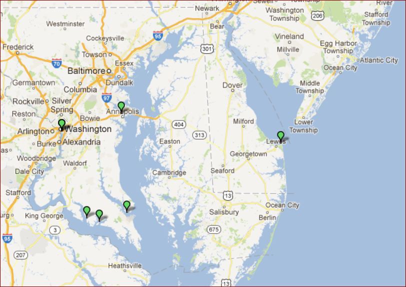
When we planned to visit the US east coast, we had intended to just spend the summer cruising the Chesapeake Bay and all its little creeks. On the way north it was way too hot to be enjoyable, and there is the risk of hurricanes, thunderstorms, no good swimming and lots of jellyfish, so we carried on north. Now, here we were in the middle of October, too cold to swim, and running out of time to relax in pleasant bays. Also, it was way past the end of holiday season, and other than Annapolis, everything was closed.
Washington DC
38 53N 077 02W Anchored 23rd October
A couple more days down the Chesapeake and we turned up the Potomac river for a 2 day run to Washington DC. We anchored in a little stub of the river outside the Gangplank marina, and Capitol YC. We had the Washington memorial in sight from the anchorage, and it was a 3 minute walk to the metro station, supermarket and bus stop. To keep fit, most days we walked to and/or from the city (25minutes) as well as spending all day on our feet in museums and galleries.
For $10/day we parked our dinghy at the Ganglank marina, and had hot showers and access to the laundry facilities there. There is a security presence 24/7, so our dink was very safe.
The famous Smithsonian Institute is based in Washington. Large sums of money were donated by Mr Smithson, a British scientist, to create an 'establishment for the increase & diffusion of knowledge among men'. Even though he had never visited the USA, the legacy was accepted and a charitable trust formed in 1836, and since then many others have contributed. An American diplomat was sent to England to collect the bequest, and he returned with 105 sacks containing 104,960 gold sovereigns (about $500,000 at the time). Now, all the Smithsonian museums have free entry and are totally marvellous.

Reporting from the White House!

There are 11 museums on the National Mall, the pedestrian grass strip in the centre of the city. We visited the air & space museum 3 times and the Natural history museum 4 times – the best thing about free entry, you can wander until your brain is completely full and then return another day afresh for more. In each museum there are docent-led tours (volunteer experts) who lead you around the exhibits and teach you even more stuff! We came away with our heads very full indeed.
My 3 most recent reads were good preparation: Moondust (Andrew Smith) about the 12 men who landed on the moon; The Greatest Show on Earth (Richard Dawkins) about the compelling evidence for evolution – loads of fossils are in the Natural History museum; and The Story of Art (E Gombrich) about how art evolved from cave drawings to modern art. If only homework at school had been that interesting.
Did this really orbit the moon in 1969 and return to earth?
Surely this was made by Blue Peter, not NASA....

Really clever people explaining stuff...

The evidence for evolution; bat fingers, giraffe necks, horses feet. I spent hours in the bones rooms, checking out heads, shoulders, knees and toes, knees and toes.

Lincoln's Memorial

WWII memorial – each star represents 100 American service personnel lost in the war, but half as many again perished in the Civil War precipitated by Lincoln's presidency.
We enjoyed all forms of art on display
The staff of the marina were a little strange but helpful. The second day we were there they told us the marina was on it's hurricane watch protocol. We were informed that the marina had been assessed and would not withstand a Cat2 hurricane, once the full hurricane plan is underway, at T minus 48hr, they stop taking new boats in and concentrate on tying down the ones they have.
Very cheery news we thought. Still lots of hurricanes and storms had formed and dissipated throughout the season, and come to nothing on the east coast, so we carried on going about the business of sightseeing with this worrying news in mind.
We considered all options for other marinas and going back down the Potomac to find a narrow winding creek to shelter from the storm, but decided that staying put with 2 anchors out was as good an option as any. We spent a couple of days preparing for the worst, taking down the foresails, stowing all the deck gear, putting chafe-proof gear on lines on both anchors, hoping that the forecasts were wrong. The worst times were, firstly, deciding where to place ourselves for the blow, but once we'd done that we could concentrate on getting our preparations done. Secondly, watching the barometric pressure plummet as the 'Frankenstorm' approached the coast, without knowing how likely the meterologists had got the forecast track right. At one point it was headed straight for us. After all, as Hurricane Sandy fused with a huge Nor'easter on its way north, it was supposed to be unique – how can you forecast a 90 degree turn if it's unique ?– but the models were right, it did exactly that and New Jersey and New York bore the brunt of it. The reconstruction is still ongoing 2 months later.
Insurance companies write clauses into our boat policies which force us north of 30 or 35 degrees from 1 June to 1 November (with some variation between companies), but really Irene last year and Sandy this year prove that latitude and dates are irrelevant. This year the hurricane season started in May, before the NOAA hurricane watch centre is up and running for the year. Sandy came along very late in the year, and well north – a tropical storm in winter weather clothes. Mad weather!!
Well, we spent most of the storm on the phone, internet and Skype catching up with people who wondered where we were, so we didn't have too much spare time for worrying. It was great to chat to everyone too. See previous blog entry for what happened during Frankenstorm.........
We left Washington behind and headed down to Portsmouth, Virginia, rejoining our northbound track. This time we took a right turn and headed into the Great Dismal Swamp canal and national park, an alternative route of the Intracoastal waterway only taken by pleasure boats of 6' draft or less.
 
The canal is still maintained by the US Army Engineer Corp and is a very pleasant narrow meander through the back country. A couple of locks maintain the depth, though we bumped along the bottom at times, probably over tree trunks in the sandy bottom. Not only is the canal free to transit, but so is the park and several pontoon berths along the way.
We did see real live bear......poo. A couple of very tame bears posed for their photos in the visitor centre.
Great Dismal Swamp Canal bears

 
Autumn has followed us south!Now all the trees are golden
Elizabeth City
Free dock 36 17N 076 13W
This town calls itself the harbour of hospitality. Not only do they provide free waterfront space for visitors to tie up, but the visitor centre lends bikes for free and there is a shuttle bus to the supermarket. We met up with a large bunch of Canadian cruisers headed south for the winter.
As we left Elizabeth City a Coast Guard RIB followed us down the channel. It was a cold, grey blustery day and Stu felt sorry for them out on the water in training, so he gave them a cheery wave. We were sailing along with full sail up, doing maximum speed in flat water. It didn't stop them coming alongside and indicating that they wanted to put 2 guys aboard for an inspection.
Although we knew it was possible that the USCG can inspect your vessel at any time, we are the only foreign-flagged boat we know that has been boarded. We had no idea what to expect..
For cruisers coming to the US, here's the full report I sent to our little fleet of cruisers up here – feel free to skip it if you like.
Coast Guard visits Matador We were leaving Elizabeth City, still in the river, a couple of miles from being out in the 'open' in the Albemarle Sound. There was a steady stream of boats, power and sail going south that morning - no idea why they picked us out, but we seem to get a visit in every country we are in! The CG was like a large RIB with polystyrene foam for sides. They indicated that they were going to come alongside and put 2 guys aboard, told us to keep our course and speed - at this time we had full sail up in 20-25 knots downwind, but thinking about reefing for the sound before it got a bit boisterous. First they asked if we had weapons on board. No, we don't.
I went below to turn off the cooker (I'd been cooking breakfast) and diesel heater and do a few pre coastguard visit things below while they were doing their high speed board. Like tidying up...
No 1 sat in the cockpit and did papers, asking questions.
No 2 wanted to be below and was told to look around,with his little list in a book (we think he was the trainee)
First job 'for their own safety' they wanted us to show them the bilge area and the engine compartment so they can see we are not sinking or on fire. Glad I turned off the diesel heater!! You can't see our bilge for water tanks, and they were content with a quick peek in the side of the engine bay.
He asked if we had a fixed fire extinguisher in the engine room ( we do, automatic)
They wanted boat papers, passports, phone number.
They wanted to see the following: Personal flotation devices for number of people on board A throw-able flotation device; A sound making device - he wanted to hear it too. We have a pump up air horn which we wondered if it is not USCG approved, but it seemed to satisfy them once we got it working after an embarrassing pause, then he nearly jumped overboard; A copy of the collision prevention regs ('international?' I asked -yes)- I couldn't lay my hands on it directly, and fumbled around looking in the bookshelves -they got bored and moved on from that; Other fire extinguishers - they said it did not matter if they were not US approved, because we are not a US flagged boat; Asked if we had an oil policy notice and a garbage policy notice - we do have home made ones, thanks to Yindee Plus. He looked at them but didn't read them; He asked if we had a standard Y valve arrangement on the holding tank. We said yes, and he wanted to see it. I'd slipped a pre-prepared zip tie on it minutes before, and he was happy with what he saw. He didn't check the sea-cock or try to pump the toilet; He asked what training or qualifications we had. Stu reeled off a list, and they didn't ask for proof. Stu mentioned 23000 miles at sea.; He kept asking if we had access to the internet, not necessarily at sea. Not sure what the relevance of that was; The trainee was still going on about 'numbers' but he was told by no 1 that we don't need them as we are foreign.
He then gave us a yellow copy of his form to keep, which shows that we were inspected and did not have any violations or warnings. I would have asked more about fines and violations, but we really just wanted them off the boat asap, and we were glad to see the back of them, even though they were very professional. We were navigating at high speed with 8' of water either side of the narrow channel - it was kind of hard to concentrate. They left and didn't rip the toerail off with their boat, unlike the Spanish CG. Any questions, email me, and if you want a copy of the oil or garbage notice I can send you one but say thanks to Yindee Plus.
Looking at the yellow paper now, there is a list of possible violations:
Numbering Certificate Document/Official Number
Personal Flotation device
Sound Producing device/ Bell
Fire extinguisher
Backfire flame control/ Ventilation
Marine Sanitation Devices
Installed Toilet and no MSD Installed
Pollution placard not posted
Garbage placard not posted
Waste management plan vsls>40'
FCC SSL Not posted/available
Operation without FCC SSL
Nav/Anchor lights (Sunrise-sunset only)
Visual distress signals (Sunrise-sunset only)
Negligent Operation
Intoxicated Operation
Unsafe conditions creating especially hazardous conditions
Overloaded
Fuel leak
Accumulation of fuel in bilges.
Before you ask, I don't know what FCC SSL is.....


Suffice to say they were professional and polite, but no doubt we would have incurred a stupid fine if they couldn't tick their boxes. In Turkey you can be fined for polluting the water with oil or sewage. In the US you can be fined for not having a sign stating your oil, garbage and sewage disposal plan, or for not demonstrating the operation of your poo handing tank.
It doesn't matter if you know the collision regulations like the back of your hand, you must have the idiot-proof chart on hand. The inspection focussed on having the correct paperwork, rather than actually what we were doing. I doubt any person irresponsible enough to throw oil into the sea, would be in any way deterred by a sign in the boat saying he shouldn't do it! The regulations are cheap and easy to abide by, so just do it. By the way, you are also supposed to carry a copy of your boat papers in the dinghy at all times, and have lifejackets for all passengers, a light and a sound making device. Instant fine if caught without – don't say we didn't warn you.
From Elizabeth City we would have liked to visit Roanoak, and the Outer Banks – the string of islands that make up Cape Hatteras. However, the water is shallow, the wind strong and wintry and we were warned that these communities 'roll up the streets' at the end of summer, and there is little to see or do there out of season. Given unlimited time, we would still have visited, but more worrying events were unfolding. For the last 3 oil changes, Stu had been finding tiny but increasing amounts of swarf in the oil strainer.
Shiny bits – but not where we like to see them!
Most engines don't have a strainer and the bits would have gone unseen into the oil filter and into the bin. But we couldn't keep ignoring these bits, even though the engine was working perfectly. The oil pressure was fine, no smoke, no noise, no knocking – nothing to suggest anything was amiss. Knowing there were friends and expert engineers at Jarrett Bay, we pulled in hoping that it would just be for a night or 2 to track down and tackle the problem.
Jarrett Bay Boatworks, 20th November 2012
North of Beaufort, North Carolina.
34 48N 076 41W
Jarrett Bay has fantastic facilities for boats and engines and all sorts of work is done here. The core business are the sports fishing boats, whose engine services cost $20000! It's amazing that they are at all interested in our puny horsepowers and cheque books. However they are as friendly and helpful as can be. The owners of these boats are in another league. It costs $1000 in fuel to go out fishing for a day – 60 miles out to where the marlin live. The engines guzzle 100 gallons an hour. Mindblowing, eh?
It is 8 miles to the nearest bar or restaurant – the perfect getaway for recovering socialaholics!!
Over several days, and either side of Thanksgiving, many people came and gave their expert advice and assistance. The engine was turned on it's side to access the sump and larger shiny bits were found.
It appeared that one of the bearings was breaking down, but as more and more of the engine was taken to bits we could not find a single bearing that was not immaculate. Pretty amazing for a 34 year old engine, proving that Meryl the Merc was well over-engineered.
Heads were scratched and many experts consulted in the yard and back in the UK. The biggest spanner and wrench imaginable were defeated by the pulley at the end of the engine and there remained no choice but to haul the engine out of the boat for further surgery.
While Brian and Gaston at Performance Diesel took the engine to bits, we sourced the parts for rebuilding the engine. All the original parts were still available from Mercedes, and most were even found within the USA, even though none of the engineers had ever seen a Mercedes engine here.
They found the cause of the problem – one lousy bearing, possibly some water contamination of one bearing from the engine refit 8 years ago. Or maybe it wasn't made as well as the other bearings – the Friday afternoon bearing.
It looks just like a cookie cutter doesn't it? I thought I might have it made into a bracelet – it's expensive enough – but Stu says it will give me lead poisoning.
We had a couple of days of confidence crisis, and started looking at new engines. However, the new ones look smaller and lighter than my sewing machine and didn't fill me with confidence. It's a whole can of worms to re-engine, to match the propeller, alternator, charging systems, control levers – a 6 month project to choose the right engine and do the installation right. As all experts agreed that Meryl still had years of good service in her, inside she looked hardly used, we continued with the rebuild. The cost of the parts to rebuild was a measly £380. The labour costs are the killer, so Stu is doing as much grunt work as he can himself.
Not a single stage of this drama was without its snags, and we even had to load Meryl into a truck and drive her 60 miles inland to a machine shop and engine rebuilders. Here 3 engineer clones who operated at the pace of the most meticulous snail, machined the new camshaft bearing to fit the hole, and tested it in the back of the truck (it was in a box to protect it from road dirt). These guys build racing car engines, and really know their stuff. You could eat your dinner off the floor, it was so clean and tidy. Its a shame that young people are not learning what these guys do, it is a whole generation of expertise that will be lost forever when they go. I have big respect for what they know,and what they can make work. They were so meticulous, considering every move before they did anything - it saves costly errors. I wouldn't like to be standing behind them in a fire though. |I can just see that the first response to Fire Fire would be to bend down and carefully check their shoe laces before making their way to the carefully calculated nearest exit. But what confidence they inspire.
 
The lovely shiny truck was lent to us by a really nice guy, for the duration of our stay. He also gave up his Sunday to help us left the engine onto it's side. Thank you so much Toby and Jessie, hope you get out and start living the dream soon! Our friends have been running around all over for us, and bringing oysters and shrimp and other delicacies to keep our spirits up.
So many fabulous, generous people have helped us out here, we will always have fond memories of North Carolina, despite the engine woes.
Well, Meryl was lowered back through the hatch onto her engine mounts yesterday, with no millimeters to spare. It will take a day or so to reconnect the spaghetti of wires and pipes, and then the moment of truth – will she still run perfectly again with no noise, smoke or nasty knockings?
Engine bay spaghetti

Meryl comes home
If so, we stand a chance of heading south to the Bahamas before our visas expire on 12th January, only 600 miles away at sea, but a lot more down the ICW avoiding the nasty weather that forms from Cape Hatteras. It is the birthplace of the depressions that head across to old England all winter.
Look out for our winlink position changing, then you'll know that we are on the move again, hopefully without the assistance of Towboat US.


Tuesday, October 30, 2012

Sandy on the rise

As of 7pm local time the National Hurricane Centre are showing that Sandy has dropped to 75 knots and the central pressure is rising. So it is now 'only' a tropical storm. Winds have not increased over the last hours, we have 20 - 30 knots with occasional gusts of around 45knots. The conditions are pretty good, no worse than an gale in Poole Harbour, actually a lot warmer!!
We're expecting lots more rain and about this much rain all day tomorrow, but all is well on board.
Have to say I'm very impressed with the accuracy of the weather predictions and the preparedness of all the civic departments both here and in New York.
Boring view of the park today, not underwater, just before sunset

Stu in his anchor watch togs

Sandy earlier today merging with the cold front from the NW. 

Sunday, October 28, 2012

Frankenstorm, Washington DC


Well, we thought we were pretty smart, spending hurricane season all the way up north in Maine, and coming south so late that we nearly froze. We didn't bank on getting a late hurricane in Chesapeake Bay – seems a bit unfair! Not just a hurricane, but it's going to blend with a big cold front to create 'Frankenstorm', as the media have dubbed it.  Lots of hype on the TV and international media, as we wait to see where Hurricane Sandy will make landfall. Hope it will go north of us, as the current forecast models show and turn up to New York, leaving us on the edge of the weather – but they are unpredictable by nature, so we have prepared the boat for the worst and can't do any more about it, but watch and wait.


There are good forecasts and radar images on www.accuweather.com for information on the current situation without the hype.
Hype aside it will be the biggest storm to hit USA in 100 years. Hopefully we will tell you more later.

Currently we are anchored in a stump of river right in the heart of Washington DC, with 3 other boats. There is a marina here, but the staff didn't fill us with confidence that it wouldn't break up, so we feel safer out on the hook, with second anchor ready on deck to be deployed if necessary. The biggest risk to the marina is the storm surge, caused by a combination of heavy rain, high spring tide and the hurricane at sea pushing the water up the Chesapeake bay so that the water backs up higher and higher. Washington DC and New York are both low lying, with poor sea defences. Also they have metro systems just below ground level, which have vents direct on the street above – if the water level rises and floods the road, it pours down into the Metro below. This is why the cities go into state of emergency and everything shuts down. With our water tanks, food supplies, sanitation and our own power, light and heat, we are streets ahead in preparation compared to the general public if they get the power outages as predicted. We 'just' have to make sure our anchor stays put in the thick gloopy mud here, and ride up and down in our little Ark as the tide rises in our protected little basin.
Well, it is now Sunday afternoon, we've had no rain and no wind to speak of. Just cloudy skies so far, and life is going on as usual around us – the Washington marathon runners just went through the park behind us. The park may well be underwater by tomorrow!

We are hunkered down with plenty of supplies and well equipped with hurricane advice gleaned from many fellow cruisers, who've sailed up and down this coast before.
I'll try and keep you posted on the weather we get, here on the blog, in the next couple of days.
Thanks for all your emails wishing us well.
Steph and Stu xx

Sunday, September 9, 2012

US of A, Matador heads north to Maine Part II


Once upon a blue moon, Matador turns around in Maine. 

Since August is a blue moon month, it would seem appropriate to do a blog update. A blue moon is when 2 full moons occur in the same month, so I'm informed. Free free to contest that.
Thanks to the 3 of you that bugged me about the lack of updates, I guess 3 constitutes an audience, so I will persevere.


Those of you who follow the winlink position (top right 3rd link down) will know that we are all the way up in Maine at the top of the USA, the last state before Canada.   This wasn't what was intended. We thought we would potter around the Chesapeake Bay until the hurricane season had passed, then head south again. Well, the main problem with this plan, is that in July and August Chesapeake is hot enough to boil a lobster alive, the water is hot, full of tannin, jellyfish and snakes. It was also having a heat wave, so we came on north until we started to wear socks and put the duvet back on the bed.  We naively thought that you went north to Chesapeake to get away from the hurricanes coming up from the Caribbean from July to November. Well, it helps, but as we chatted to people in each location, they remember hurricane Irene, in New York, in Boston, in Cape Ann, and found that superyachts come all the way to Maine to weather hurricanes in the excellent protected anchorages here. Yes, that means hurricanes come all the way up here – sometimes. Well, you probably also know that they go all the way to England and create horrible summer storms too. But, they will be much, much less bad than staying in the Caribbean, or Florida.

Our internet sessions always start with the excellent www.nhc.noaa.gov website, which tracks and predicts tropical storms, and you can check out all the previous years tracks too, and learn the difference between tropical depressions, tropical storms (TS)and each category of hurricane – so I don't have to explain it.  Our insurance companies write TS clauses in our contracts that force us to certain latitudes by certain dates to ensure coverage for damages. The tropical storms had a really early start in May this year, we watched them pass us by in the Bahamas, as they went up the US coast. TS Beryl chased our friends up the US coast – their insurers told them to be north of 35 degrees by 1 June. Beryl went right over them at 35N on 2 June, and we enjoyed  a few more weeks down in the Bahamas, out of the tracks because of different insurance. Lucky our friends didn't get too much wind, or any damage, but they were forced into that position by their insurance cover!
After Beryl and Chris in June it all went quiet for a while. Now they are lining up one after the other, Leslie being the latest,as they work through the alphabetical names.  So we are happy to remain up here for a few more weeks, until long sleeves and trousers become the daily attire, and then it really will be time to head south to the sun again.  We don't want to get frozen in for the winter.
Maine is a beautiful cruising ground, with many bays rivers and natural anchorages. Dolphins and seals are all around, and occasionally whales can be seen. The waterline is thick with trees and there are plenty of opportunities for walks and cycles.  We like it so much we might even come all the way back next year!!

It's dual drawbacks are frequent fog and zillions of lobster pots. The sea bottom must be crawling with lobsters this time of year, and the cost is down to $3/lb of live lobster.  Not even the big ship channels are left free of pots – they are just everywhere, so it doesn't make for very relaxing passage making. We have to be on our guard constantly so as not to run one down and get it wrapped around the propeller or rudder.  Add 100m visibility to the mix, and it doesn't make for a fun day on the water.  Now September is just around the corner the autumnal weather brings clear blue skies (after the cold fronts), warming sun and a nip in the air, and unfortunately for yachties, a bit of mildew!


Bangor, 26 August 2012 LATITUDE: 44-46.49N LONGITUDE: 068-47.19W
Our northern most point in Maine was Bangor, up the Penobscot river, the venue for the American Folk Festival. It is a 3 day event featuring music that reflects the roots of America's settler history from Indian hoop dancing, tap dancing cowboys (I kid you not), swing bands, blues, cajun, bluegrass, afro-american and latin american music.  As well as lots of fiddling and banjo playing it was a history education in itself. There was even a band of guys, all of Croatian descent, looking like the mafia playing little guitar things – they were awesome.


We picked up a mooring at Waterfront marina, 2 miles downstream of the festival and enjoyed peace and quiet on the river between music sessions. We were reminded how much we enjoy pottering up rivers, away from the turmoil of the sea, it is so peaceful and pretty up there.

Now we are back in Camden for the Windjammer festival, pretty old wooden schooners with no engines, beautifully restored to their heyday glory. After racing, they are pushed back into the  bay by little boats – traditionally they would have been rowing boats I guess.


There are lots of watery activities planned for the weekend. We're here with Yindee Plus, Daydreamer, Full Monty, Interlude and Moonshadow, old friends and new ones thanks to the SSB radio, and our net at 9am on 8161. It has been really great for keeping in touch with others up and down the coast, and ensured we have had plenty of opportunities for socialising.

Well, here is a run-down of the places we have visited on our way north. Hopefully you can see why we haven't had time to write about it!

Castine &Smith Cove 21 August 2012
LATITUDE: 44-22.34N LONGITUDE: 068-46.83W
Castine is a historic old town, occupied by the Brits in 1812 in a 'humiliating' defeat according to the tourist leaflet.  You can wander the leafy avenues and admire the restored homes of the rich and successful. The town has 300 huge elm trees, carefully saved from the the nasty dutch disease.  We enjoyed the music on Waterfront Wednesday and an organic farmers market (Thurs) – a bit of an expensive treat, but very welcome after the half-frozen supermarket offerings that turn to mush as soon as they reach the boat.


Smith cove, a 2 mile deep bay is a very pretty anchorage, with exceptional sticky mud. It is a hurricane hole, meaning it has 360 degree protection from wind and waves. Superyachts come from New York to anchor here in bad weather.  With a bit more time we would have explored the numerous walking tracks and cycled the gravel track among the gorgeous holiday homes in the forest. Initial explorations ended in a bit of a mosquito misery, so we'll go armed and prepared next time around. It would be a great place to gunk-hole, and see to Matador's peeling varnish and UV degraded canvas work – but the Windjammer Fest and friends beckoned.

Pulpit Harbour, North Haven
LAT 44-09.24N LONG 068-53.07W
Another gem of an anchorage.  We wrestled the bikes into the dinghy and ashore. It was such a luxury to cycle in chilly air again. We discovered an oyster store (24 hour with honesty fridge) and Stu gorged on a bakers dozen for $10. Myself, I can't see the appeal of slurping grey blob from a briny shell, but lots of people seem to love it, so I must be the odd'un. For an island store, North Haven is very unusual, having a wealth of good quality products from around the world, and not at crazy island prices. We partied with Kurt and Katy on Interlude and had a lovely dinner and a bit of music practice with them – they played, we practiced.

Camden and the Ocean Cruising Club 20 August 2012
LATITUDE: 44-20.97N LONGITUDE: 069-04.87W
Camden Yacht club were hosting the Ocean Cruising Club meet, so we came here to meet up with a few of the members. There were a bunch of younger cruising couples (Serafina, Saltwhistle III, Egret, Blue Highway and Makushla) in the club. We joined them for the lobster dinner and decided to join up. You need to have completed a 1000 mile ocean passage and be nominated by a member. The benefits are the knowledge and help from a host of Port Officers in various locations, who do their utmost to welcome transient club members  visiting their home towns. It must be an extensive knowledge base of people who have cruised all over. Well, we'll see after the first year if we think it is worthwhile and report back.  We would have joined them for their mini-cruise-in-company, but we were committed to Bangor Music festival and couldn't do both.

Rockland Harbour  Lobster galore
44-06.00N 69-05.94W
Like many other bays in Maine (and the US in general) mooring buoys have proliferated in the last 10 years, without much thought for us transient folk who like to lay our anchor for whatever reason, cost, comfort, size or preference.  Where the charts show a 'designated anchorage area' it is usually stuffed full of mooring balls and we are no longer 'allowed' to anchor between them, being relegated to the outskirts of the mooring field, or in some cases, such as Belfast, outside the harbour altogether and in the swell. But to be fair although some of the best spots or anchorages have disappeared we have successfully anchored almost everywhere with one exception ( see Plymouth) and been welcomed by harbourmaster and the locals, all the same.
Moorings a plenty in Rockland, but still a bit of room for us on the edge. It was a very arty little town, and a comfortable cycle to the supermarkets, which makes a change. We celebrated our 10,000 miles passage from Turkey (and 20,000 miles overall) with a meal at the excellent Lobsterman's restaurant. So called, because, guess what, he is a lobsterman. He goes out at 5am and pulls up his pots, brings back his catch for the day, then starts work in his restaurant preparing pounds of lobster, crab and other shellfish. It was excellent food and really good value – we have not matched it anywhere else in Maine. We plan to go back and Stu has asked if he can go out on the lobster boat to see how it all works. I will eat my hat if he gets up at 5am to go out on a chilly morning without whimpering, but we'll see.
Is it true that people start to resemble the food they eat?
Boothbay Harbour 17 August 2012
LATITUDE: 43-50.88N LONGITUDE: 069-38.08W
We didn't find much to commend this place – well, it was raining as well. Stuffed full of holiday makers and had the tourism takeover. I guess we should give the towns credit for the restoration of their waterfronts, and the proliferation of eateries, but it seems to us that the towns have lost their individuality – they all have the same look and feel and it's hard to see any local people or find real community events. This felt like a roll'em in, rip'em off and shutdown for winter type of place.
(Apparently there are lots of pleasant anchorages around Boothbay so we'll visit those next time rather than the town)
The redeeming feature of towns like this is the pubs serving beer and cider from local micro-breweries and hosting excellent bands. At one such bar, with a very entertaining band, at half-time the guitarist offered around some interesting home-made cookies with a distinctive smell and taste– guaranteed to ensure his audience appreciated the second half even more.

Yes it is!!

Jewel Island 15 August 2012
LATITUDE: 43-41.36N LONGITUDE: 070-05.37W
A little get away from it all island, to celebrate our arrival in Maine. There is nothing ashore except some walking tracks leading to WWII watch towers to climb and admire the view. Lovely little place given over to campers and boaters. I even had a swim and as a result of the extremely cold water had an endolphin experience – like endorphins, but you only get them in cold water. To understand you need to read Waterlogged, an sublime book by Roger Deakin.

Ile de Shoals 13 August 2012
LATITUDE: 42-58.76N LONGITUDE: 070-36.79W
A strange little anchorage formed by building low breakwaters to join up 3 islands in the middle of nowhere. Plymouth Yacht Club have laid some moorings here for members, but are free for the use of others when no members are on them. It would be a bit of a bummer at the end of the day to be turfed off and have to go out to sea, but that is unlikely if you avoid visiting at weekends.  The island is owned by and home to a large church, and is a private retreat, but visitors are welcome and apparently not subjected to any unwelcome brainwashing activities.

Rockport 8 August 2012
LATITUDE: 42-39.71N  LONGITUDE: 070-37.21W
We quickly exhausted the lobster shacks and tourist trap shops of Rockport (who needs to buy overpriced sun-dried tomato paste, or Spanish paprika on holiday in Maine?) we tried to leave for more northern shores. It is quite pretty and looks a lot like North Brittany where we spent most of our summer sailing holidays, learning skills that the average US sailor never gets the chance to  practice, like anchoring in strong currents and high tides. Dodging crab pot markers and blind navigation in fog, Still the pink granite boulders on the shoreline and sublime evening light conditions make us reminisce about those crazy days.
At 6am, 7, 8 and 9 we peeked out and it was still foggy. At 10 we left, sailed straight into thick fog, thought 'why are we doing this?' and went back and anchored again. By the afternoon the fog had cleared, and we decided to go back south 10 miles to Gloucester to try for the Blues Festival there. We anchored in the inner harbour and found the harbourmaster very helpful. It was a bit tight among the fishing boats at anchor but asked the harbourmaster's advice and found a spot with swinging room. There are moorings for a very reasonable $25 a night, but no pressure to take one.

Gloucester 10 August 2012
LATITUDE: 42-36.63N LONGITUDE: 070-39.41W
The town is a real working-class hard-man deep-sea fishing harbour. We weren't put off by the noise from the fish-packing factories and a thousand fat seagulls, or even some rain.
Once you get the locals talking they are friendly and fascinating. The Andrea Gale (of Perfect Storm fame) was based in this port, and the deep sea fishing heritage is in evidence all around.
Old schooners like this would have fished the Grand Banks
We went for a drink at the Crow's nest pub (look it up on Tripadvisor) and watched the closing ceremony of the Olympics. Having a few beers and missing dinner the landlady let us order and eat a Chinese take away there. They are so friendly,and we met the local characters. I would move to this town so it would be my local pub. There is a certain reluctance amongst the people we met for the town to be beautified and the waterfront to be developed. We agree, keep it as it is, fascinating, unique and a bit rough around the edges - there's nothing wrong with that. The noise and clatter of boats unloading the days catch and a buzz around the docks of people making a just but hard earned living from the sea, beats the glamour of people making an all smiles, hard milked living out of passing tourists and holidaymakers, sitting on docks eating seafood imported from other surviving fishery towns. These tourist fishing towns are devoid of noise and smells, and completely missing the reason why the docks are there in the first place. We can name several holiday towns where people come from far and wide to eat fish /lobster and there isn't a single fishing boat in the port. Gloucester is not like that and we hope it stays that way.
There is an interesting cycle around the classy north shore. We came across a Stop and Shop supermarket on the way back (about a mile from the harbour). Great supermarket with lots of stuff we were despairing of ever finding at reasonable prices - olive oil, cheddar cheese, British tea bags, UHT milk etc. We tentatively asked if they did deliveries and the young manager said, yes indeed, why not? and delivered our shopping to the coast guard station in her own car!!

So the purpose of our stop was to attend the Blues festival - a first for Gloucester. The line up included Eddie Shaw and Lucky Peterson - names which didn't mean a lot to us, but were obviously big ones! It was a great day out, and followed up by free live music in one of many bars in the harbour loop.


So a great little town, friendly people, interesting history and we'll be back for more on our return trip down the coast.
There is a train link to Boston city from Gloucester (about 1 hour and you can take your bike) so that might be the easiest way visit the city, and we might do that on the way back south.
(Note 2 public dinghy docks - next to CG boat and harbourmaster office, for town, or Cripple Creek cove for the north shore. Laundromat, big pharmacy/convenience store, about 5 mins walk from CG).

Plymouth (of the Mayflower fame), Massachusets.
41-57.86N 70-38.80W
The Mayflower - a replica

We aimed here as a convenient stop and to catch up with Full Monty stuck in the marina doing essential boat works, and in need of cruiser company. We found that mooring buoys had been put in the only decent anchorage near town, and the harbour master charges $40 a night ( no facilities). So now you can anchor in a tight spot north of the moorings, but someone has to stay on board, or anchor out in the Cow yard 2 miles out (and keep someone on board). We took a mooring and headed in to pay our dues. We found the rudest and most grumpiest American yet in the harbourmaster/police office. First he growled about us tying up our dinghy (which was well out of the way as it turned out), then barked had we cleared customs, phoned Customs&Border Patrol etc, which we had. Then he slammed down a form and barked - fill that in. There were 2 young officers in the office with him, who were good-naturedly chatting with us at the time - fancy them having to work with such a grump every day. We offered up our cash - but they don't take cash ( as someone has had their hand in the till previously - this being the police!) and no cards - only money orders or cheques - which we don't have, not being locals. So he gave us a business card and told us to post one once we got round to it.  “I promise the cheque is in the post.”
We had a great night with Full Monty, and didn't get around to visiting the town, which has far too many tourists for it's own good! Thanks to Mr Grump we decided to move on the next day.

Thursday, September 6, 2012

US of A Matador heads north to Maine Part I

Onset Harbour and Cape Cod Canal 6 August 2012

LATITUDE: 41-44.10N LONGITUDE: 070-39.04W
Onset harbour is a delightful little spot, a very protected anchorage just before the canal entrance. Nice little village ashore, but the shop only had vegetables older than the ones I had on board, and no meat (There's a farmers market on Wed 12-4).
Just a few miles away is the Wareham river. New England has so many familiar place names, Portland, Plymouth, Portsmouth, Weymouth, Gloucester, Southampton - but no Poole, which is bizarre as Poole was a bustling sea port in the days of the settlers. Perhaps it was so rough, that no-one wanted to name a new settlement after it!! Bournemouth was still just a pile of sand dunes in those days.

The Cape Cod canal is 15 miles long and totally free (unlike the Corinth canal at $6 a minute!)- it saves going out into the rough currents of the Cape. With the current in our favour we were swept along on a magic carpet and spat out into the clearer and much colder water (19C) of Cape Cod bay.
Swimming in the Bahamas is now a long distant and cherished memory.


Cuttyhunk Island and Long Island Sound.
5 August 2012 LATITUDE: 41-25.70N LONGITUDE: 070-54.94

On entry to the Long Island Sound fog banks started to close in. We used the radar for the first time since Gibraltar. A small target turned out to be a fishing pot marker, then the same size radar target a few minutes later turned into an idiot sports fishing boat tied to a buoy, like a sitting duck and at the end of a major shipping lane. He loomed out of the fog about 100 yards ahead, and we swerved around him. He looked quite surprised to see us! Lucky we weren't an oil tanker!!
The fog lifted and we decided to extend our trip to get to Cuttyhunk island. As we came around the corner into the outer anchorage we were surprised to see about 60 boats there. We dropped anchor behind Yindee Plus, and the fog immediately rolled in and we couldn't even see them - though we could hear the kids playing on deck - better than a fog horn! It stayed for the night, as thick as a heavy curtain, until the morning sun burnt it off and we could explore the island with Sue, Chris, Sid and Wilf.

The Cuttyhunk historical society were particularly interested to hear about our kiwi friends Chris and Irene, and their boat named Cuttyhunk - now in the Pacific, and were really keen to know about the history of the boat. Turns out that it was the favourite place of the previous owner - as simple as that. Who know's why we are called Matador, which means killer in Spanish!

Cape May, Atlantic City and Barnegat Light Inlet.
These were just quick stops for us on the way north up the Long Beach of New Jersey.
Cape May (27 July, LATITUDE: 38-57.03N LONGITUDE: 074-53.07W) is a busy tourist sea-side town with lots of perfectly preserved large Victorian weatherboard seaside houses. It goes to show the prosperity of the town (and the country), so close to New York.  We are used to seeing Victorian seaside houses in abundance in UK, but not normally so beautifully painted and preserved - more often in some decline, like well-heeled old ladies whose clothes are starting to be worn and shabby.
Couldn't resist the sea food here, got stuffed two nights in a row at the Lobster House, a simple fish market that cooks and provides meals in take out packaging to eat at free tables along the dock side. We had 6 Oysters on ice and Crab soup for starters, King prawns x 12 or so, then Shrimp stuffed with Crab and Devilled Clams all with coleslaw, chips and dips and of course 2 pitchers of Blue moon beer. Remarkably the dinghy still planed all the way home, good job as we could barely walk. Total about $65. You could easily be satisfied for about half that but that's not the USA way. Fishermen elsewhere could do well to take a look at this model instead of complaining about the wholesale price for lobsters, currently under $3 per pound, up north. If a few were to get their heads together in many of the ports, and go direct to the consumer, their future might look considerably brighter.

Atlantic City - just a convenient anchorage with high rise casinos all around. Did not go ashore!! LATITUDE: 39-22.88N LONGITUDE: 074-25.33W

Barnegat Light Inlet LATITUDE: 39-45.58N LONGITUDE: 074-06.98W. 2 Aug.
Nice anchorage and friendly bar ashore, free music on the beach at the bandstand. No free public dock for the dink - in this area all of the foreshore is owned and private/off limits/ or only for fee-paying customers.
Would be lovely kayaking around here among the sandbars, but dangerous waters, by the sound of the number of calls to the coast guard around here. In one day, we heard of a heart attack on a fishing boat, a boat on fire and a couple of people missing in the water. Next day 2 boats taking on water - as well as the many plonkers who've run out of fuel and need a tow. Note that the currents do run fiercely in the entrance and cause considerable turbulence,you should certainly watch your step if you don't want to join in the coast guard conversations.
We did hear a call to the tow boat U.S. for assistance as a shark had bitten through their hydraulic steering hoses. Not sure if the shark was still on board but I bet the towboat man had a story to tell that evening.
Since healthcare and ambulances are not free here, it would  be interesting to know who foots the bill for the coast guard services. Should mariners carry their credit card when they abandon ship? Have asked locals, but no-one knows!

Thoughts on shopping in the US.

After the sparse and expensive pickings of the Bahamas, we were so looking forward to fresh food and proper supermarkets in the US. The first meal out for me was a salad - and it was heaven.
In the UK we think we have lost the heart and soul of our towns and cities to out-of-town shops. Well - it's still all local compared to here. Here, you can find the odd gas station/convenience store selling 30 types of coffee, soda cans, the odd snack, terrible bread and fresh milk, but for more than that you have to jump on a bus (ha ha if there is one -likely not) or head out of town on the highway (forget cycle paths) for several miles to the malls. There you will find the giants of Walmart etc on the cheap land where they can display their huge range of goods. You are just very unusual if you don't have a car. Everything is geared to the car owner - including drive through ATMs, banks, pharmacy - actually not a bad idea at all, especially in the UK climate. In the towns such as Beaufort, Charlestown, Rockport the town centre is given over to supplying the tourists with boutique goods.
So our provisioning has been done when people have given us lifts (rides) to the malls out of the kindness of their hearts.  Many towns have a farmers market once a week, for a couple of hours, but just as in the UK, the prices reflect just how much hard labour goes into growing stuff out of sun, soil and water, without the subsidised mass production of the giant farms (Stu: plus chemical additives and of course the assistance of the ever pervasive Monsanto!! Check out their inventions including , Killer gene (seeds that grow sterile plants meaning you have to buy seeds for ever more-they are great to donate to 3rd world countries when crop failure causes famine), Agent Orange to mention a couple of their success stories.)
We are still using our European supplies - from LIDL, Mercadona, Carrefour - and are glad for what we bought at those prices and pushed through the water with sails for 5000+ miles!

Everyone we have met (except for the grump in Plymouth) has been welcoming, polite, helpful, interested and interesting. And white. The demographics of the US overall are certainly not reflected on the east coast. Well, that is until you take the bus. Then it is rare to see a white face, unless they are disabled folk, or maybe an occasional student.
A lot of towns don't have buses at all. So guess what - no coloured folk in evidence at all. It is really weird. Watching the Olympics on TV has made us realise how wonderfully diverse, integrated and enriched UK society is.

Portsmouth - Norfolk Stopover and the Sail-through marine store.
36-48.79N 76-18.31W 24 July 2012
Somewhere along the way, we found out about Active Captain, a kind of Tripadvisor for Boaters. It overlays points of interest on nautical charts and details many anchorages and free stops. This is fantastic because all pilot books for the US, and the Caribbean for that matter, are basically funded by the advertisements of the marinas and businesses – anchorages are barely mentioned and there are no little plans of how to enter harbours or bays – lots of chat about lobster meals instead. Rod Heikell – all is forgiven, please come and write pilot books over here. Marinas here are charging $80-120 per night so anchorages and free docks are very welcome.
So, this is how we found out about High Street Landing in the heart of Portsmouth town, and right next to the ferry for Norfolk, Virginia and all its big town attractions.  We were informed to ignore the 'No overnight Mooring' signs and to stay in the little basin for as long as we liked, so long as we were supporting local businesses. So we visited Bob's Mile Marker 0 Marine store – right on the landing and our first Sail-through marine store. Bob is the salt of the earth. He will find anything he can for you, drop you at the Walmart store, help sort out any problems you have. And he took us all to his house for a BBQ and to see his train set , well train room actually. What a guy! We're  just  bowled over by the hospitality here.
The only drawback to the free dock- underwater at high tide.

We had some parts of order with Bob, and while we waited for delivery we explored Norfolk and Portsmouth. This is the home of the US Navy and the Military Academy. We watched an Aircraft carrier pass our little harbour, and visited the Naval Museum and the USS Winsconsin, which saw action in the first Gulf War and the Pacific in WWII. It fired shells as heavy as a VW Beetle.


Its not everyday that an aircraft carrier goes past your mooring
Visiting an exhibition of classic motor beach boats (think James Bond style) we were surprised by the signs at the entrance – no surprises for no ball games, no climbing on the boats etc etc – but the invitation 'If you feel like shagging, Just do it! ' was a bit of an eye popper for us.
Lucky we thought twice about taking them up on it, as a shag is a beach dance over here. Just be warned of the dangers of thinking you speak the lingo.

Two free museums deserve a mention:
First the Chrysler Glass Museum and workshop – a fabulous and generous collection of fine works collected by Mr Chrysler in his lifetime and a modern workshop where you can be fascinated by all types of glass-blowing and glass work in action, and then see the fine pieces in the museum too. Well worth a whole day out. My favourite piece is this chess set of Jews vs Catholics


Second, am I the only one who doesn't know my McArthur from McCarthy? It seems not. The place to find out is the McArthur Memorial museum for a full run-down of 20th Century history from the USA perspective. McArthur's impact on the Phillipines and Japanese history is remarkable, as he reshaped their post-war societies into modern democracies, proving that in some cases, meddling in the affairs of other countries can be very successful. He got the sack in the end, for his difference of opinion over Korea.  The New World is proving to be just as interesting and cultural as the Old World of the Med was in other ways.
MacArthur not McCarthy


Great Bridge, another great free dock
36-41.41N 76-12.81W
A very pleasant free dock

A lovely little overnight dock at the end of the twiddly bits of the Intracoastal Waterway.
It was the most convenient stop for shopping so far, just a short walk to a mall with supermarket, hairdresser, electronics and fabric shop and thrift shops – like our charity shops but supermarket sized, and now the only way we can afford new outfits! Perfect little yachtie stop. We had a slightly longer stay than we anticipated when the bridge failed to open, and once it was repaired it was too late in the day to do the next leg. Lucky no-one shooed us off, so we took the bus to Walmart for more retail therapy.
Stu saw lots of snakes in the water, which along with the dark brown tannin stained water, put us off going in for a much needed cooling dip. It was continuing to be unbearably hot. Didn't know so much of the body is covered in sweat glands.

The IntraCoastal Waterway
Well part of it, from Oriental to Great Bridge, avoiding the perils of the seas around Cape Hatteras, the grave yard of many ships and where the bad weather always comes from on the forecasts.
We spent several days following the magenta line on the charts that marks the inland waterway through North Carolina and into Virginia ( It goes all the way south to Miami too, which we hope to do later in the year). It travels across sounds, up the Alligator river and Pungo river, creeks and canals, providing an ever-changing vista of waterfront homes, trees, bird-life and beaches as well as the less glamorous industrial outskirts of towns. We found it a welcome change from the endless blue of the ocean.
The channel is marked with red and green buoys, Americans have them the opposite way round to the rest of the world – we constantly chant the mantra 'red right returning' to keep us off the mud, but  have to watch out for when it suddenly switches direction – as in the complicated twists and turns of the ICW, it all depends on what port you are returning to!


The ospreys find the channel markers very handy for building nests too.  They can wait for several years get a place on the property ladder, to find a place to nest and raise a family, so no horizontal surface stays unoccupied for long.
Concentrating on staying in the channel and out of the mud is quite tiring, and some days you have to do 60 miles between anchorage. Other times, you just decide on how many miles you want to travel for the day, and pick where to drop the hook for the night, pulling off the ICW into one of many delightful anchorages.  It helps to have Yindee Plus in front, as they are very organised and work out the times to be at the opening bridges!

The waterway was built for commercial shipping, similar to the canal systems of Europe. It utilises rivers and lakes with a series of man-made links between them. It is suffering these days as the lack of commercial traffic allows silting to take place where previously the constant wash of barge tug propellers acted as a continuous dredging system. Now the tugs that still use the waterway, are  augmented with dredgers, but the cost of dredgers puts the long term survival of these waterways in the balance. Recreational boating has it's modern part to play in the survival of this wonderful canal system. Still with a couple of exceptions we had no problems navigating these waterways and friends with 7' draft found the same. The tight spots are well documented on active captain and if you are wise you'll join up with Tow Boat U.S. As a precaution. It's more likely you will slump into a moment of relaxation than run out of water IN the channel but however it happens, it's nice to know there is a tow boat near you.  Once a paid up member, it's absolutely free no matter how stupid, Sorry, unlucky, you can be.


Oriental and Small Town Americana
35-01.38N 76-41.90W

The little town of Oriental saves its 4th July celebrations for its Croaker Fest the following weekend.
We spent the weekend there with Yindee Plus, Alexina of Shoreham and Daydreamer. There were the delights of Miss Oriental beauty pageant, and the Miss Minnow contest for aspiring 4 year old beauty queens (favourite colour unanimously pink) and the hotly contested Baking Contest.


We enjoyed some local music of various bands, and absorbed the cultural charms of small-town life. We particularly enjoyed the parade where any form of conveyance was proudly exhibited, including the entire regional Fire Brigade with their new and vintage appliances on display. (Don't catch anything on fire on this day) I particularly liked the Chilly bin (cool boxes) that had been converted to electric-powered three-wheeled speed machines and the tractor steered by an excited wife so keen to wave and grin at her friends she nearly ran over several of them. If it hadn't been for the last minute panicked grabbing and violent swinging of the steering wheel of her ever-smiling forgiving husband it may have been a sorry tale.


Beaufort to Oriental and back again and again.
34-42.3N 76-41.3W

Our arrival in Beaufort was not the perfect text book approach. We never aim to arrive in a new port in the dark of night, especially with no moon. So arriving in the early hours with a following breaking sea down a confusing channel with no moon was, to say the least, nerve racking. Once anchored opposite the coast guard station in the outer bay and a stiff drink later we retired to sleep off the 36hour passage. We were awoken in the early morning with the passage of the shrimp boats followed by the sports fishers followed by the weekend beach and speedboat lovers. Rock and roll is not dead in Beaufort. Once we had gathered our bearings we nipped up to the “No Wake Zone” an area we have learned to seek out, as it is generally adhered to.  Outside of that its a free for all, including a great deal of the ICW, despite the damage done by large wakes along the edges of rivers and waterways.
We anchored off the town right on the waterfront. Anchoring space is a little tight in peak season, and due to the wind conditions we blocked most of the  channel, however the commercial traffic  passed unperturbed and waved and smiled. Anywhere else we have been in Europe we would have been severely intimidated until we moved, but not here. It all seems to be about sharing the space,  and all's OK, even when groups of people swam across and down the channel, ferries and fishermen alike would move around to accommodate.
We were to learn that is just the way they are down here. Y'all have a good time, and come back real soon y' hear!
It was shrimp (Prawn) season so that's what you eat whenever you can and it is the freshest and best you can imagine. Shrimp burgers, fried shrimp, shrimp with wassabbi, Love It.

Beaufort waterways

So, you can't travel nearly 10,000 miles in 14 months and expect nothing to go wrong, can you? Our antifouling bottom paint was failing and couldn't cope with the warm waters. We were scrubbing the entire boat before any long passage only to be fouled within a week. Here in the waterways it's not one of our options to scrub. The water is dark brown with tannin from the trees and the silt from the inner plains and swamps. These waters have sharks and snakes that you can't see. It's not swimming territory for us. Back in Barbuda we had met a lovely couple on a boat who gave us their card and bravely said come see us if you come to Beaufort. They happen to be heavily connected to the Jarrett boat yard in Beaufort. So that's where we lifted out to repaint the bottom.
Mike and Connie looked after us so well, both at their house and with daily supplies of ice and vegetables from their garden. What lovely folk!

I can recommend the yard for anybody wanting to crack on and get work done. There are no distractions other than a few people who live onsite for a BBQ in the evening but everything you could need as far as expertise and services can be found here. When you build sports boats that cost $1000 per hour to run, then everything is 'yes sir, of course I'll help you'. Turns out that it's not the money talking, it's just the way they are. The yard was clean so were the showers etc but if you want night life and a bar, oops. We focused and in a week we had the topsides and bottom sides all to perfection just before the 4th July long weekend. We launched ASAP and zipped up to Beaufort for 4th July celebrations. Distant fireworks but free music every night in the water side bars. Then, we did 20 miles up to Oriental to catch up with Yindee Plus and others at the Croaker Fest. Then back to Jarrett Bay boatworks to collect the last of our mail from the UK after the long weekend. We waved goodbye to Jarrett Bay friends, and set off again to Beaufort planning to give moral support to friends with engine and electrical problems. We didn't make it 30 minutes out of Jarrett Bay before we joined the Gremlin club. I'm not saying you can catch gremlins but they are really keen to jump ship to ship. With a great deal of smoke and some awful noise we ground to an engine-less stop. Main engine circulation pump bearings seized and contorted. Steaming hot coolant hissing from the pump, and smoke from the disintegrated fan belt erupting from the engine bay. Bloody Gremlins, was muttered. A  handy towboat nearby, seeing the smoke, stopped and asked if we needed assistance. Despite being a different operator and a competitor of our chosen Towboat US outfit he was all smiles and called our guys who arrived in 20 mins. That's the equivalent to the RAC calling the AA to ensure you're not stranded. Respect!
We asked if he would tow us all the way to Maine,
but he said we didn't have enough beer on board!


Within an hour we were back in Jarrett bay yet again. The tow would have cost in the region of $300 so our $150 joining fee is redeemed. A new waterpump was delivered for our 33 year old engine in 2 days courtesy of Detroit Diesel and Mercedes, and we were free to move on again. Just a series of 2 more smoking and disintegrating burnt out fan belts, and we would be back to our usual reliable old Mercedes. Well done old girl!!


Checking in at Charleston, South Carolina. 21 June 2012.
32-46.5N 79-57.3W

Funny weather continued to plague us in the Bahamas and a short weather window appeared for a quick passage to the US coast. We left on a Sunday without checking out (you can post the forms back to them, once in the US) and set out to find the magic carpet of the Gulf Stream, which we all know carries warm water north up the US coast and then across the Atlantic to bathe Britain in balmy waters, so we can grow palm trees on the west coast.
Well it turns out it is only a piddly little trickle in these parts, and we found only a frustrating counter-current for most of the 75 hour, 450 miles passage to Charleston.  (Next time we'll head west towards Palm Beach, get into the piddle and stay in it going all the way north, but really powerful thunderstorms travelling north with the warm stream prevented us from doing that this time)

Anyway, we arrived at Charleston, South Carolina at 7pm. Before we could settle down to anchor we were directed to the City Marina dock to be met by Customs and Border Protection. Several friends had checked in further north at Beaufort, and had their lockers and fridges inspected, and non-US meat products and milk confiscated, and even had to boil their fresh eggs, while CBP stood and watched over them.
Several of us checked in at Charleston that day, and none of us were inspected. I had made my basil plant into pesto, expecting it to be removed, but it was butchered in vain. We were stamped in with big smiles all round and welcomed to the US of A. We already had a cruising permit from Puerto Rico waters (see other blog entry). Those who did not, simply had to visit the Customs office in town the next day to get theirs. No sweat.
It is totally up to the CBP officer of the day as to whether to admit you or not, and how long to allow you to stay, so we breathed a big sigh of relief and set about exploring the pretty historic town.


We also had to find phones, internet connections, propane gas and all sorts of other boring stuff that is always necessary on entry to a new country.
The biggest surprise is that there are no real shops in the town, so several hot and sweaty bus trips were made miles out to Walmart, Radio Shack, Best Buy and many others, in search of the elusive perfect phone/internet solution. Surely in the great big successful technologically superior USA  that couldn't be that hard, could it?  Well, think ourselves lucky in the UK that the EU has kept our markets open and competitive. Not so here, the big corporates rule, and even though you think you have consumer choice, your needs are meaningless if they aren't going to make heaps of money from you. All phones are locked to the supplier. Some are not even GSM (Verizon do not have SIM cards). Without a Social Security number and a ZIPcode you cannot get a contract even if you want one. Data bundles are stingy and expensive, compared to Europe.
We couldn't utilise any of our existing dongles or smartphone or Nokia. We had to purchase a MIFI thing ($120) and a monthly top up of $35 just for internet access. We decided not to buy a 'drug phone', (so called as the drug dealers use these no contract, anonymous off-the-shelf phones) as the rates are not much better than our international phone. For the first time we are in a country where you have to pay to receive any call !!!! Unbelievable.
Learning to cross the road in a new country!


Well, consumerism aside, the country and people are warm and welcoming and we spent a very pleasant week waiting for our next weather slot to head north out of hurricane territory (or so we thought!), to achieve the Holy Grail of 35degrees north. We were all set to enjoy 6 months of pottering peacefully around until the hurricanes were all over. How little did we realise we would be going nearly all the way to Canada!!